
Castle Consulting (U.S.) was the first company in the world to focus primarily on Geographic Information Systems (GIS) applications in the real estate industry. As an unabashed champion of the benefits of GIS technology, Castle Consulting throughout its history has balanced – in equal measure – consulting engagements, customized system development projects, and educational activities. Clients have come from all levels of the organization, including C-level executives.
In recent years attention has shifted to India. Not only is the Subcontinent arguably the most rapidly expanding economy in the world, but also is on the verge of having the largest and most sophisticated cadre of GIS professionals on the planet. (If Horace Greeley were alive today, his advice would most likely be “Go east, young man!”) Accordingly, Castle Consulting India was founded in 2009 to provide the GIS-related products and services described at this Web site, for clients in India, the United States, and the rest of the world.

 Mr. Gilbert H. Castle is the founder of Castle Consulting. He has been a GIS consultant
since 1978. Prior to starting Castle Consulting, he was a Regional Director of the
real estate consulting division of Deloitte & Touche. Mr. Castle is a Past President
of the Urban and Regional Information Systems Association, North America's largest
and oldest professional society for GIS practitioners. He has more than 150 publications
and conference presentations to his credit, primarily on applied computer technology
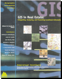
in land use decisions. For example, he is responsible for two seminal books – GIS
in Real Estate (1998), shown to the upper right, and Profiting from a Geographic
Information System (1994). For several years he also wrote the real estate column
for Business Geographics magazine. Mr. Castle has lectured at numerous universities
on applied GIS technology, including the Massachusetts Institute of Technology,
the University of Pennsylvania, Stanford University, the University of California
at Berkeley, Texas Tech, and Georgia Tech. He holds a Bachelor of Science degree
in Economics, Cum Laude, from Harvard University, and a Master of City Planning
degree from the University of Pennsylvania.
Mr. Gilbert H. Castle is the founder of Castle Consulting. He has been a GIS consultant
since 1978. Prior to starting Castle Consulting, he was a Regional Director of the
real estate consulting division of Deloitte & Touche. Mr. Castle is a Past President
of the Urban and Regional Information Systems Association, North America's largest
and oldest professional society for GIS practitioners. He has more than 150 publications
and conference presentations to his credit, primarily on applied computer technology
in land use decisions. For example, he is responsible for two seminal books – GIS
in Real Estate (1998), shown to the upper right, and Profiting from a Geographic
Information System (1994). For several years he also wrote the real estate column
for Business Geographics magazine. Mr. Castle has lectured at numerous universities
on applied GIS technology, including the Massachusetts Institute of Technology,
the University of Pennsylvania, Stanford University, the University of California
at Berkeley, Texas Tech, and Georgia Tech. He holds a Bachelor of Science degree
in Economics, Cum Laude, from Harvard University, and a Master of City Planning
degree from the University of Pennsylvania.
 Dr. Murali Krishna Gurram has 12 years of functional experience in the broad spectrum
of Geoinformatics (GIS, Remote sensing, Photogrammetry, Digital Image Processing)
technology and its applications. Before joining the Castle Consulting India, Mr.
Gurram worked for various prestigious organizations in private sector as well as
premier scientific and research institutes in India, which have been recognized
as the centers of excellence. He started his career as a Senior Research Fellow
and worked at Regional Remote Sensing Service Center, ISRO, Dept. of Space, Nagpur
and Dept. of Geo-Engineering, Andhra University, Visakhapatnam. Later he participated
in the GIS & Remote sensing program sponsored by Center for Space Science and Technology
Education in Asia & Pacific (CSSTEAP), affiliated to United Nations, Dehra Dun.
He has 10 publications to his credit in various reputed international and national
journals, and also authored the articles for newsletters and scientific journals.
Mr. Gurram has extensive expertise in interdisciplinary domains including: Web GIS
Application Design & Architecture; AM/FM; Municipal Management Systems; Growth-Risk
modeling; Sustainable Urban Development; natural resource management; environmental
impact monitoring, assessment, analysis and management; Wetland/River-Delta Environmental
Analysis, Biogeomorphology and micro climate change etc. He holds these degrees:M.Sc.
(Geography), M.Phil., Geo-Engineering from Andhra University; P.G.D. and M.Tech.
GIS & Remote sensing from Centre for Space Science and Technology Education in Asia
& Pacific, affiliated with United Nations; M.Sc.-IT., Kuvempu University and Doctoral
degree in Management Studies (DMS) from IIBMS, affiliated with the London Community
Training College, UK; and B.Sc. Geology, Physics, & Chemistry from Nagarjuna University.
Dr. Murali Krishna Gurram has 12 years of functional experience in the broad spectrum
of Geoinformatics (GIS, Remote sensing, Photogrammetry, Digital Image Processing)
technology and its applications. Before joining the Castle Consulting India, Mr.
Gurram worked for various prestigious organizations in private sector as well as
premier scientific and research institutes in India, which have been recognized
as the centers of excellence. He started his career as a Senior Research Fellow
and worked at Regional Remote Sensing Service Center, ISRO, Dept. of Space, Nagpur
and Dept. of Geo-Engineering, Andhra University, Visakhapatnam. Later he participated
in the GIS & Remote sensing program sponsored by Center for Space Science and Technology
Education in Asia & Pacific (CSSTEAP), affiliated to United Nations, Dehra Dun.
He has 10 publications to his credit in various reputed international and national
journals, and also authored the articles for newsletters and scientific journals.
Mr. Gurram has extensive expertise in interdisciplinary domains including: Web GIS
Application Design & Architecture; AM/FM; Municipal Management Systems; Growth-Risk
modeling; Sustainable Urban Development; natural resource management; environmental
impact monitoring, assessment, analysis and management; Wetland/River-Delta Environmental
Analysis, Biogeomorphology and micro climate change etc. He holds these degrees:M.Sc.
(Geography), M.Phil., Geo-Engineering from Andhra University; P.G.D. and M.Tech.
GIS & Remote sensing from Centre for Space Science and Technology Education in Asia
& Pacific, affiliated with United Nations; M.Sc.-IT., Kuvempu University and Doctoral
degree in Management Studies (DMS) from IIBMS, affiliated with the London Community
Training College, UK; and B.Sc. Geology, Physics, & Chemistry from Nagarjuna University.
 Mrs. K. Nooka Ratnam has 10 years of experience in the technology domain of GIS
& Remote sensing and their applications to natural resources, (especially water
resource) and environmental resource monitoring and management. She started her
career working for a prestigious scientific organization, Regional Remote Sensing
Service Center (RRSSC), ISRO, Department of Space, Government of Space, Kharagpur
and had a stint with various reputed private organizations. She has extensively
worked on innumerable aspects of city level geodatabase creation and management,
growth-risk modeling, micro-watershed prioritization, etc. She is well versed with
GIS analysis, digital image processing techniques, remote sensing data processing,
interpretation, data extraction and modeling algorithms. Mrs. Ratnam has published
her work in various international and national journals. She holds a B.Tech. degree
in Civil & Environmental Engineering, M.Tech. Remote sensing & GIS, M.Sc.-IT, Kuvempu
University and Doctoral degree in management Studies (DMS) from IIBMS, affiliated
to London Community Training College, UK.
Mrs. K. Nooka Ratnam has 10 years of experience in the technology domain of GIS
& Remote sensing and their applications to natural resources, (especially water
resource) and environmental resource monitoring and management. She started her
career working for a prestigious scientific organization, Regional Remote Sensing
Service Center (RRSSC), ISRO, Department of Space, Government of Space, Kharagpur
and had a stint with various reputed private organizations. She has extensively
worked on innumerable aspects of city level geodatabase creation and management,
growth-risk modeling, micro-watershed prioritization, etc. She is well versed with
GIS analysis, digital image processing techniques, remote sensing data processing,
interpretation, data extraction and modeling algorithms. Mrs. Ratnam has published
her work in various international and national journals. She holds a B.Tech. degree
in Civil & Environmental Engineering, M.Tech. Remote sensing & GIS, M.Sc.-IT, Kuvempu
University and Doctoral degree in management Studies (DMS) from IIBMS, affiliated
to London Community Training College, UK.
 Dr. Mahesh Pratap Singh has extensive research experience in the field of macro-economics,
development economics, applied and core analytics. Most recently he has been involved
in the development of retail attractiveness and consumer segmentation models relevant
to Indian consumers, at both the inter-city and intra-city levels. He has written
scholarly articles and given presentations especially dealing with interdisciplinary
field of regional development. He has worked in various capacities with Investment
consultancy, Analytics firms and Development research organizations. He has been
awarded Doctorate from Jawaharlal Nehru University, New Delhi for his work on the
“Contract Farming and Emerging Agrarian Space: A case of Punjab”. His additional
degrees follow: M.Phil in CSRD, Jawaharlal Nehru University, New Delhi, in 2002;
M.A. in Geography from CSRD, Jawaharlal Nehru University with specialization in
Regional Development and Remote Sensing in 2000; B.Sc. with Maths, Physics and Chemistry
from Lucknow University in 1997.
Dr. Mahesh Pratap Singh has extensive research experience in the field of macro-economics,
development economics, applied and core analytics. Most recently he has been involved
in the development of retail attractiveness and consumer segmentation models relevant
to Indian consumers, at both the inter-city and intra-city levels. He has written
scholarly articles and given presentations especially dealing with interdisciplinary
field of regional development. He has worked in various capacities with Investment
consultancy, Analytics firms and Development research organizations. He has been
awarded Doctorate from Jawaharlal Nehru University, New Delhi for his work on the
“Contract Farming and Emerging Agrarian Space: A case of Punjab”. His additional
degrees follow: M.Phil in CSRD, Jawaharlal Nehru University, New Delhi, in 2002;
M.A. in Geography from CSRD, Jawaharlal Nehru University with specialization in
Regional Development and Remote Sensing in 2000; B.Sc. with Maths, Physics and Chemistry
from Lucknow University in 1997.
 Mr. Venkat Rao Tammineni has 5 years of functional experience in the field of GIS,
focusing on GIS software development. He is especially well versed in developing
customize analytic tools and user interfaces, for both desktop and Internet GIS
products. His areas of technical expertise include the following: ArcGIS 9.3 Desktop,
C#. Net, VBA (Arc Objects) & VB6.0 COM (DLLs), ArcXML9.0, ArcIMS9.0, ArcEngine9.3,
ArcGIS Server 9.3, ADF9.3, and Open Source modules like UNM Mapserver5.0 and PostGreSQL/PostGIS.
He holds a M.A. degree in Geography from Andhra University and M.Tech. GIS from
JNTU, Hyderabad.
Mr. Venkat Rao Tammineni has 5 years of functional experience in the field of GIS,
focusing on GIS software development. He is especially well versed in developing
customize analytic tools and user interfaces, for both desktop and Internet GIS
products. His areas of technical expertise include the following: ArcGIS 9.3 Desktop,
C#. Net, VBA (Arc Objects) & VB6.0 COM (DLLs), ArcXML9.0, ArcIMS9.0, ArcEngine9.3,
ArcGIS Server 9.3, ADF9.3, and Open Source modules like UNM Mapserver5.0 and PostGreSQL/PostGIS.
He holds a M.A. degree in Geography from Andhra University and M.Tech. GIS from
JNTU, Hyderabad.